The Lake Baikal
General Information
Age. Baikal is one of the earliest lakes of our planet, its age is identified as 25-30 million years old. There are no signs of ageing like in other lakes which live 10-15 thousand years. On the contrary its shores diverge at speed of 2 cm a year. Scientists suppose Baikal to be an aborning ocean.
Water. Baikal is the purest natural reservoir of clear water on earth. There is no any more another opened water body in the world which is good for filling of fresh water. Low-mineralized Baikal water is perfect for human organism.
Volume. Baikal is the largest reservoir of fresh water on our planet. Its volume is 23 thousand cubic meters. There are 20% of world fresh water recourses of the whole planet.
Depth. Baikal takes the top place in depth among lakes of the world (1637 meters).
Depth of Baikalskaya trench. Baikalskaya trench is a central part of the Baikal rift zone which is formed by Tunkinskaya, Barguzinskaya, Muyskaya, Charskaya, Tokkinskaya and Verkhneudinckaya parts. Depth of the trench is estimated by height of the mountains above it, depth of the lake, and thickness of the bottom sediments. The deepest point of the bottom sediments is at depth of 6-8 thousand meters below sea level. Trench roots dissect all the crust and extend to upper mantle to the depth of 50-60 km. Explorations show anomalously high temperatures of subsoil under the lake. It is the deepest trench of the planet.
Storms. Baikal is also one of the stormy lakes. The strongest storms usually happen in Olkhonskie Vorota strait, at mouth of Chivyrkuiskiy bay where wave height can exceed 4 meters, and near northern shore of Bolshoi Ushkaniy island where wave height comes up to 6 meters. Maximum wind speed is in April, May and November, minimal is in July.
Baikal winds. There are about 30 settled winds known at Baikal. Centuries of observations have revealed their regularities. Wind speed is often more than 15 m/s.
Verkhovik (Angara) – is a northern wind blowing from the valley of northern Angara river. There is sunny weather with this wind. It can blow constantly up to 10 days of more. In November and December verkhovik shakes Baikal in the middle with waves 4-6 meters high.
Barguzin. A strong wind which blows in the central part of the lake from the valley of Barguzin river across and along Baikal. This wind usually brings sunny weather.
Kultuk. This wind blows from south end of Baikal along all the lake. Causes rainy weather and storms. Blows primarily in autumn.
Gornaya – flank wind, west and north-west, blowing from mountains. This wind is catchy and develops speed over 40 m/s. It starts suddenly and becomes strong very fast. Blows in October and November.
Sarma – a type of gornaya wind blowing from the Sarma river valley. Its speed is more than 40 m/s. It’s a hurricane wind, its force becomes maximum within an hour or sometimes quicker. The cause of it is a river valley which becomes narrower towards its estuary. This wind caused losses of ships.
Baikal-Amur railway. Building of the Baikal-Amur railway started in Stalin timed and finished in the 1920th.
Olkhon Island
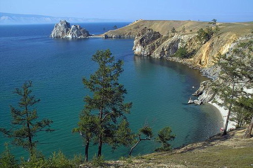
The biggest Baikal island. Its length is more than 70 km, width is about 15 km. This island is considered to be a stronghold of modern shamanism. There are many cultural and natural monuments and places of interest. Nature landscape of the island reproduces all the landscapes of the Baikal area. There are mountains, steppes, taiga, unique wind-laid sand dunes, and cliffy coasts dropping into emerald green waters of the lake.
Maloe More (Small Sea)
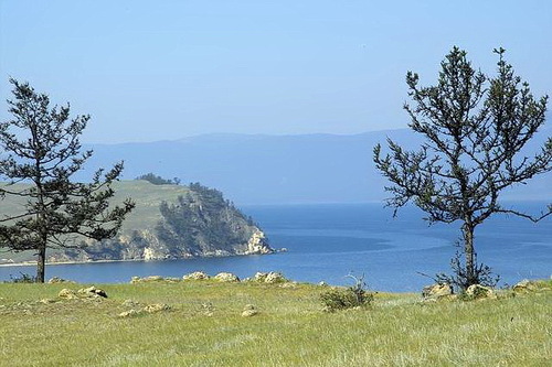
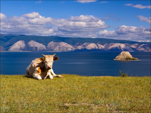
Small sea, Narin-Dalai in Buryat, “narrow sea”, is a segment of Baikal separated by Olkhon island. Its length is 76 km, the broadest part is 17, and the narrowest is 4 km. This vast shallow part of the lake is rich with fish. Maximum depth is 200 meters. As local people and fishermen say, fish caught in Small see is tastier than the same fish caught in another part of Baikal. Water in shallow gulfs warms up to 21-22 C. It is the sunniest place in Irkutsk area, there are no gnats and moths. In southern part of Small sea, Mukhor gulf (Mukhar is the right transcription, “tight corner” in Buryat) there are many tourist camps, but it’s quite possible to find a solitary spot for independent rest. You can travel along the shore on foot, by bike, by car or riding a horse. Currently quads, mountain bikes and paragliders are offered at tourist camp. It is 250 km from Irkutsk to Small sea.
North Baikal
North Baikal nature is notable for its originality and unspoilt purity. Trips usually start from Severobaikalsk town, population of which is about 30 thousand people. The town looks rather beautiful because architects from St. Petersburg took part in its building. Places of interest here are mineral sulphurous springs and Baikalskiy edge with the highest point at Cherskogo mountain. Peaks of the mountains are covered with glaciers, river valleys with impassable brushwood of cedar elfinwood. Animal kingdom is very rich, from bear to sable. Inhabitants of Baikal region say that really wild nature is only in North Baikal.
Baikalskiy edge
The highest point is Cherskogo mountain, 2588 m. Category of difficulty of the route is 2А. The first stated climbing was made by geodesists in 1961. The way to come to the mountain is from Cape Kotelnikovskogo where a health resort is placed, based on a thermal spring, the only spring of west shore. There is an equipped building for 25 people. Water temperature in the spring is up to +81 C. Also there is a wooden bathing crib on the lake shore. Strong hydrogen sulfide flavor comes from the spring. It’s possible to come from the cape down Kurkula river to Gitara lake, a nature sanctuary of Buryatia. Above the lake river makes cascade of waterfalls about 150 meters high. Territory here is already severe – piles of stones and glaciers. It’s not very far from here to Cherskogo mountain. Opposite the mountain is Lozhnyi peak 2386 meter high. It is easier for climbing than Cherskogo mountain and here opens a view to the mountain which allows to see the climbing route in details. Route to Cherskogo mountains can be performed from Baikalskoye village but this route is only for experienced climbers. Main difficulty is nature of the region. For instance, cedar elfinwood is impassable for tourists with back packs. Travel speed over the elfinwood is only 500 meters an hour. Cedar elfinwood has rounded brunches going up to 2 meters and forms barely passable brushwood. That’s why you should go along dried-up stony river beds.
Other points of interest of North Baikal:
Mica lakes are 25 km far from Severobaikalsk, 2 km in diameter, have sand beaches.
Dzelinda thermal spring, 92 km far from Severobaikalsk. Rich in fluorine, silicic acid and radon.
Gudzhekit spring. 25 km far from Severobaikalsk. Rich in fluoride and hydrocarbonate. There is a hotel complex “Khozyain” for 56 people. There is also a ski slope (200 meters) with T-bar lift.
Frolikha bay and Ayaya bay. Frolikha bay has formed after a glacier which went down into the lake 10-12 thousand years ago. It was one of the biggest glaciers on Baikal, its supposed length was about 500 km. The bay goes into the land for 3 km. Ayaya bay is one of the most beautiful places in North Baikal. Deeply gone into the land, for 4 km, the bay has sand beach and picturesque shores, severe climate and unusual flora. On a nab near the Ayaya bay seals have their rest when the weather is sunny. 8 km far from Ayaya there is a glacial lake Frolikha. The lake is lying far from the coast, surrounded by wild taiga and dissected by mountain river valleys. The only way to here is on foot. The lake length is 9 km, depth is about 80 meters. Water temperature in summer is about 20 С. There is a unique fish of glacial age, davatchan. Also there are lenok, grayling, perch, taimen. Preglacial plants are found.
Holy Nose peninsula and Chivyrkuiskiy bay
Holy Nose. It is a large mountainous peninsula 53 km long and 20 km wide, the highest peak is 1877 meters. There are many gulfs and bays on the flanks which directed to Chivyrkuiskiy bay. Earlier this peninsula was an island but later an isthmus formed which is named Chivyrkuiskiy. The peninsula is covered with pine, larch, cedar, birch and alder woods. Mountain ridges are occupied by bald areas or high-mountain tundra. Flora is diverse. The peninsula is very interesting for tourism. Beaches and bays are from the east side. It’s possible to climb up the mountain, the pathway starts near Monakhovo village.
Chivyrkuiskiy bay. Its area is about 300 square meters. Formed at a place of transverse thrust which separated the Holy Nose from Barguzinzkiy edge. He length is 26 km, width upon 12 km. Depth of the bay in about 10 meters and water warms up to 23 C. Bay shores are covered with dense forest, there are many beautiful gulfs, capes and sand beaches. Eastern and western shores are high and have a lot of gulfs, capes and peninsulas. Southern shore is formed by alluvia of Barguzin river. These alluvia are series of sandy banks 1.5 meters high. The banks are covered with pine and mixed forest, hollows between them are filled with bogs and lakes. The largest lake is Arangutay.
Zmeinaya Bay. Here is a sodium sulfate-bicarbonate spring of the same name. Water temperature is from 28 to 34 C.
Khamar-Daban
It is a system of mountains from 40 to 90 km wide. The highest point is Khan-Ula mountain 2371 meters high. The edge goes for 350 km from east-south shore of Baikal. There are more precipitations falling over a year than in other areas of Baikal. That’s why flora is richer and more diverse.
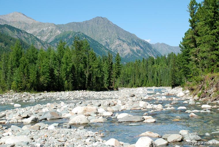
In river valleys there are glades of tallgrass taller than 1.5 meters. You can also see relict plants as a poplar Populus suaveolens, Baikal anemone, etc. Trees sometimes are really giant – poplars are two girths wide, cedars are three, ferns are taller than man. There are legends among local people about radioactivity of the place but in fact there are all relict plants of preglacier period. Main rivers are Snezhnaya, Utulick, Langatuy, Babakha, Khara-Murin. Snezhnaya is the largest and abounding in water. It is accessible for passing in its lower part and partly in upper and middle parts. At the river head there are heavy-going canyons. Once during the travel over Snezhnaya canyons we have found about 40 fords in icy scorching waters in one day, water was breast high.
Tunkinskaya valley
The valley is a continuation of Baikal hollow. It’s unique because of its mineral springs (there are about 400 of them there), alpine meadows and mountains. The length is 200 km and width is from 30 to 20 km. From west it is limited by Tunkinskie bald mountains up to 2500 meters high, from west there are Khamar-Daban flanks. The landscapes are the most beautiful and are not touched by human activity. Borders of administrative area coincide with boundaries of the national park established in 1991. It is the biggest national park in the country. Main valley river is Irkut. There is a good asphalt-paved road along Irkut which goes to Mondy village and Mongolian boundary.
Tunkinskaya valley resorts are Arshan, Zhemchug and Nilova Pustyn. Distance from Irkutsk to Mongolian border is 304 km, to Nilova Pustyn 257 km, to Arshan resort 210 km.
There are many religious places: Nilovskiy datsan, “Tamkhi Baryash”, sacral place Stupa Dashi Gaman sculpture.
Arshan is the most well-known and attended resort of the valley. It was established in 1920 and has the first category mineral waters. There are many vacation hotels and tourist camps where excursions, walking tours and climbings are organized – to Arshanskiy pass, climbing to Liubvi peak, excursion to the Bowl of virgins, to waterfalls of Kyngarga river. Not far from Arshan there are volcanoes and traces of volcanic activities of glacial period.
There are two places of interest near Mondy village. Astrophysical laboratory with number of telescopes is located on Chasovye (2000 м) hills. There is one of the largest solar telescopes in Russia. Munku-Sardyck mountain is 3491 meters high above the sea level. White peaks are covered with ice and snow, the mountain is considered to be holy among local tribes.
Behind Mondy village and Nukhu-Daban pass opens up seldom visited Okinskiy district. The nature is wild here, the peculiarities are lifeless malpais and cones of ancient volcanoes – Kropotkina and Peretolchina.
Mineral springs near Khoito-Gol river.
Springs of Shumak valley
Shumak is a unique medical centre in the open air. There are three crust fractures there and mineral, thermal and radon waters go up in them. A combination like this is unique and exists only here. Purest mountain air enriched with aromas of herbs and fir needles increases its healing influence on man. Numerous researches prove that local springs, mountains and air cure not only body but also spirit, setting it free of everyday rush and stresses. Shamans and other religions representatives often come here to take up a charge of positive energy. That’s what people call this place – Shamans Valley.


